Around The World on C-47 Skytrain is our next big project after ALSIB! This page will be update.
Participants of the project:
- Meow (He is the initiator of the project.)
- Alex
Each participant should have:
- Plane: VSKYLAB С-47 Skytrain (site). Please note that WE DO NOT ACCEPT AWXDC3, the free C-47 model for X-Plane 11.
- SmartCopilot (click here), the cockpit shared plugin
Additional tools and programs
Weather: [XPGFS] NOAA Weather, free plugin (site) – in the process of discussion.
UPD 28/10/2020: we found that the best method to see the same weather conditions is creating weather file in ASXP then disactivate ASXP and then both participants upload this file in X-Plane.
LittleNavmap is a free open source flight planner, navigation tool, moving map, airport search and airport information system (site)
Basic rules of the project “Around The World on C-47 Skytrain”:
- At least one shared cockpit flight on C-47 should be present in each event.
- All excorts are welcomed (i.e. if someone wants to excort our flight on his/her plane – we can fly in formation). Visualisation and radio communcation is possible via VATSIM.
- It is possible that a new person can study VATSIM rules during flights under supervision of more experienced pilot.
- VFR and IFR flights
- Weather always real (source NOAA or VATSIM). For example if weather is bad, we should wait…
- Crews:
- Alex / Meow (Russian)
- Alex – Magic (English)
- We will use only one skin for all the project.
- Names of participants will be on the nose of the C-47. The list of names will change if a person will join us or someone will leave.
- We will publish video and puctures on our site (and vatsim.net, x-plane.org etc) during the process of this big jouney.
- Long flights will be devided to two and more parts via this simple procedure:
- Pause during the flight;
- Save current situation in X-Plane;
- Load the situation when we will have a time for continue.
- Virtually our group has ONLY one aircraft. It means that next flight (regardless of crew) must contunue from the airport where we stopped last time.
- Flight path can be passed via interesting places
- Home town
- Native town
- A famous place
- An interesting place
- etc
- Do we need to present always in VATSIM or in IVAO? A topic fo discuss.
This is a draft of basic rules. Please write your suggestions, corrections, ideas or thoughts as comments below.
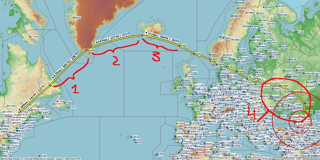
Flight path
Draft of the general path up to Canada

| No | Departure | Destination | Distance | ~ Time | Crew | Notes |
|---|---|---|---|---|---|---|
| 1 | URMN | URWI | 174 nm | 0:57m | Alex / Meow | Done! |
| 2 | URWI | URWW | 146 nm | 1 h | Alex / Meow | Done! via VORs no GPS Video in Rus here. |
| 3 | URWW | UUOO | 267 nm | The flight was divided into two parts. | Meow / Alex | Done! GPS only for SID and approach. |
| 4 | UUOO | UUBP | 225 nm | 1 h 32 min | Meow/ Alex | Done! GPS only for SID, STAR |
| 5 | UUBP | UMMS | 223 nm | 1 h 20 min | Meow/ Alex | Done! We used VORs and NDBs only fo navigation. It was our first stream (Video in Rus here). |
| 6 | UMMS | UMMG | ||||
| 7 | ||||||
| 8 | ||||||
| 9 |
